

Description
The Persian Gulf is a very enclosed basin where global and regional models do not have enough spatial resolution to reproduce the marine climate accurately. Therefore regional wave, level and current hindcasts have been developed in-house, using 2D Hydrodynamic and Spectral Wave numerical models, to create high resolution hindcasts in the area for the period 1-January 1995 to 31-Dec-2024.
Key features
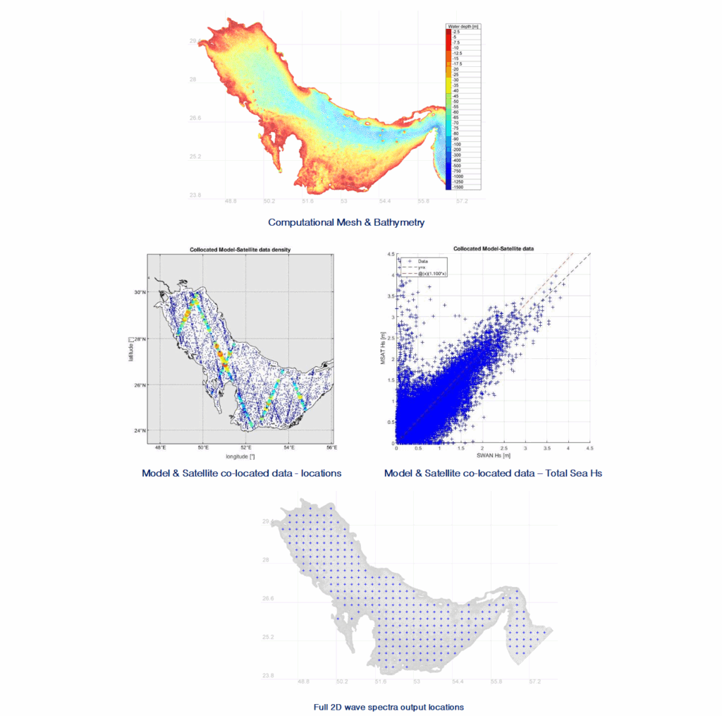
- An unstructured mesh with spatial resolution varying, as a function of depth and distance to the coast, from 0.05 to 0.025° was used to set up the models
- Bathymetric data from the General Bathymetric Chart of the Oceans (GEBCO), version 2025, was interpolated at each node of the unstructured mesh to produce the bathymetry
- Satellite measurements from GlobWave Project and from the NOAA Jason-2 and Jason-3, from 1995 to 2022 were used to calibrate the ERA5 wind hindcast
- TELEMAC 2D model, version v8p2r0, was used to carry out the hydrodynamic simulation of the water levels and currents across the model’s domain. The model was forced with time & space varying wind and pressure maps from ERA5, and total currents and level time series, obtained by merging data from TPXO and CMEMS PHY-001-030, at the model’s open boundary. Half-hourly time series of total water levels and depth averaged currents were stored at each mesh node.
- SWAN (Simulating WAves Nearshore) model, version 41.51, was used to carry out the numerical simulation of the waves. It was forced by wind maps derived from the ERA5 hindcast, as well as total water level varying maps, obtained from the TELEMAC 2D simulation, and hourly time series of full 2D wave spectrum data, obtained from the ERA5. Hourly time series of total sea integrated parameters were stored at each mesh node and the full 2D wave spectrum was stored at about 300 points across the model’s domain.
- Preliminary model validation against satellite measurements from GlobWave Project and from the NOAA Jason-2 and Jason-3 was performed for the whole basin.