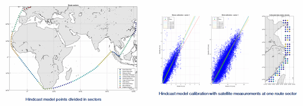
These studies provide wave and wind data along routes to support the design of sea fastening and topsides. Hindcast model points for waves, winds and currents are extracted along the route and analysed to derive requested data (usually design criteria or fatigue data)
Two approaches can be used to derive transportation design criteria:
- Calculation of adjusted extremes as described in DNV Marine operations guideline DNV-ST-N001, which produces the following deliverables:
- 10-yrp cyclone and non-cyclone extremes of wind speed and sea states for the route (at the worst sector, or at all sectors)
- Non-cyclonic exposure adjusted extremes for the route
- Monte Carlo Simulations, which are used to simulate thousands of voyages and produce a probability distribution of maximums from which the wave and wind value with a specified risk of exceedence can be derived. The usual deliverables include:
- The values exceeded once in every 10, 20 and 100 tows, which correspond with the value of wave/wind distributions of maximums at the 90th, 95th and 99th percentile levels
- Additionally wave and wind fatigue scatter tables for the route (Hs vs. Tp or Tz, Hs vs. vessel heading, U10 vs. vessel heading) can also be provided, either using the Monte Carlo Simulation approach, or from the hindcast model points along the route
- Mean surface currents can also be obtained from readily available hindcast points along the route
Such studies typically take around 1-3 weeks.


