Background
Cyclonic and non-cyclonic MetOcean data was required to support the Front-End Engineering Design (FEED) of an LNG facility in the Gulf of California, Mexico.
Scope of Work
CA Metocean was appointed by DNV UK to carry out the study, including cyclonic and non-cyclonic numerical modelling of the wave and hydrodynamic conditions and provision of the required deliverables at several locations across the project site.
Key Features
- Due to the very shallow depths at the locations of interest, with some in the intertidal zone, it was necessary to use a very high resolution computational grid to capture the flooding and drying due to tidal level variations
- Twenty-six years long hindcast of non-cyclonic waves and flows was created in two phases:
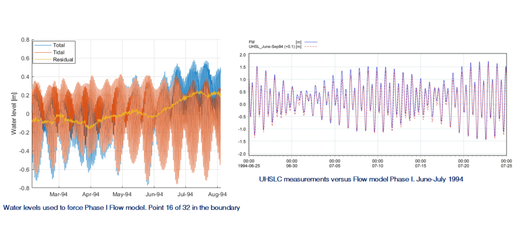
- Phase I: covered half of the Gulf of California and was based on bathymetric information from charts and public domain. The flow model was forced with total sea levels along the open boundary as well as wind maps, and calibrated using measurements at Bahia de Los Angeles. The wave model was forced with regional hindcast and water levels from the flow model, and the results verified against satellite measurements in the area.
- Phase II: was based on a combination of detailed survey bathymetry and 3rd party satellite derived bathymetry around the interest area. The flow model was forced using levels obtained from Phase I along the open boundaries. The wave model was forced with water levels from Phase II flow model and spectral wave data from the wave Phase I run.
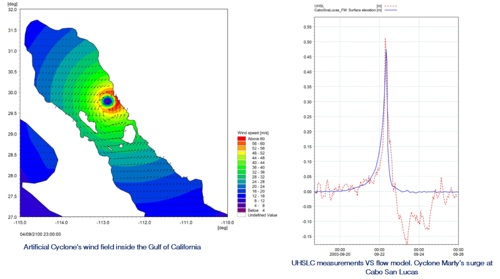
- Five cyclones (four real and one artificial) were simulated using both wave and flow numerical models. Measurements of the surge elevation for one of the cyclones was used to calibrate the flow model
- Modelling of Wave Breaking Zone was carried out by simulating cyclonic and non-cyclonic extreme sea states on constant sea level and without wind


