Background
Tow Route Criteria was required to assist in a transportation from India to Oman.
Scope of work
CA Metocean was appointed by Sea Delta Marine & Offshore to provide MetOcean criteria for two route options. Deliverables for the routes included the non-cyclonic 90th 95th and 99th percentile levels of non-exceedance (P90, P95 and P99), of the 1-minute mean wind speed, significant wave height and associated range of peak energy period based on Monte Carlo Simulations.
Key features
- Recent developments in computational modelling and satellite measurements, have made it possible to have access to long-term reliable wave and wind data all around the world
- As noted in DNV Marine operations guideline DNV-ST-N001, using these long-term data sets, it is possible to develop tow route criteria with a specified risk of exceedance in a single tow by performing tow simulations.
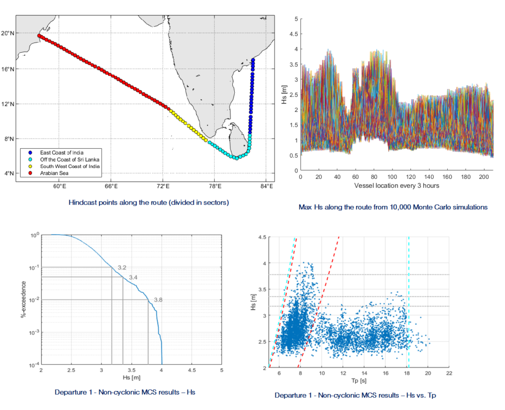
- Monte Carlo Simulations were used to derive Tow Route criteria as follows:
- ECMWF ERA5 wave and wind data (from 1st January 1979 to 31st December 2021) was retrieved at each available hindcast point along the route (~100 points in total) and calibrated against satellite measurements
- For the specific departure date, the position of the vessel was estimated every 3-hours using the transport’s reduced speed
- The month in which each waypoint of the route is crossed by the vessel was calculated and used to pick a random sample from the monthly wave and wind database at each point, creating a complete simulated voyage
- This random process was repeated to create thousands of simulated voyages (10,000), and for each of them, the maximum wind and wave experienced along the route were retained
- The probability distribution of these tow-maxima was then used to determine the value with a specified risk of exceedance in a random tow (90th 95th and 99th in this case)


